Virtual Short Course: Introduction to Geographic Information Systems Short Course, January 6-12, 2021
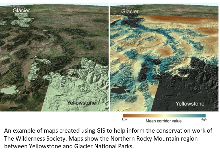
EcologyPlus partner, The Wilderness Society, hosted a virtual short course introducing basic concepts of GIS, data management and analysis, and ArcGIS software. Participants learn ed about the variety of questions that can be addressed with spatial data, different types of spatial data, data analysis, and map making. This was great opportunity to learn about a tool and approach that is widely used in ecology, physical science, and many other fields including business, political science, economics, criminology, etc.
The course ended with each participant analyzing data and sharing what they learned to the class in a short 5 min presentation on Tuesday, January 12.
ANTICIPATED LEARNING OUTCOMES
At the end of the course, students will:
- understand different types of spatial data (raster and vector),
- how to use common GIS tools (clipping, summarizing data by zones), and
- become familiar with ArcGIS software.
No previous knowledge or experience is necessary.
TECHNICAL REQUIREMENTS: This course will require a windows-based computer with at least 8GB of RAM and ESRI’s ArcGIS software.
INSTRUCTOR
Travis Belote, Lead Ecologist with The Wilderness Society.
- Questions? Contact ecologyplus@esa.org